The Retain Photos Settings, formerly Retained Photo Layer Settings, allows the user to specify the photos to be kept for geotagging and export to photogrammetric software packages using Export Photo Package or for processing in Agisoft Ortho Mapping
or Ortho Mapping
. The notion of “Retained Photos” creates a layer of photos on a new layer called “Retained Photos.” These settings are selected from the Create Trajectories
, Geocoding LiDAR
, Sensor Processing Launcher
, and other dialogs and refer to the photos to be kept for downstream processing.
Retain Photos within Flight Lines
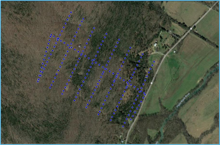
This option retains only the photos that occur between the start and end of each flight line (flight lines were defined in the prior Create Flight Lines step). This option eliminates photos in turns. (Recommended). Selecting the option to “Retain Photos within Flight Lines.” creates a new layer in the Table of Contents (TOC) called “RetainedPhotos”. The resultant layer is shown in Figure 1. Note that only photos that are between the beginning and end of each flight line are retained.
Retain Photos within Flights Lines and Interior Turns
This option retains all photos from the start of the first flight line (start as defined by GPS time) and the end of the last flight line. Thus, all ferry line photos are retained.
Retain All Photos
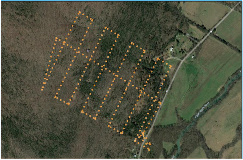
All project photos are retained. As shown below in Figure 2, all photos retained.
Tips
You can delete additional photos on the RetainedPhotos layer using the Feature Edit Delete Selected Features tool. Only photos associated with this layer will be geocoded and exported as a photo package, which greatly eases the setup of downstream tools.
Note also that the RetainedPhotos layer behave as a normal Photos layer. This means that the image view panes appear if you open this layer in Feature Analyst.
Comments
0 comments
Please sign in to leave a comment.