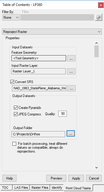
LP360 has a Point Cloud Task (PCT) that can reproject raster layers, create pyramids, and JPEG compress.
The PCT is named Reproject Raster. This PCT supports Raster Reproject operations to a new output file. It writes output .srs files with the same base filename as the output file(s). After executing this PCT, a new layer will be added to the TOC with the reprojected data.
When we reproject an existing orthophoto to a new coordinate system, or re-write to a different unit, the user can choose to output uncompressed, or JPEG compressed.
If JPEG compression is selected, the user may select the q-factor (quality factor: 100 highest quality/least compression, down to 1, lowest quality/most compression). The user can also choose to make overviews (pyramids). When making overviews, we use 2x2 averaging as the pre-filtering method, before decimating.
The "Batch Processing" checkbox forces reprojections when doing batch processing and there are different datums present.
Comments
0 comments
Please sign in to leave a comment.