
Intensity values can be determined within LP360 in a couple of ways.
Identify Tool
The Identify Tool can be used to determine the intensity value for any given point that is currently loaded into LP360.
Figure 1: Identify Tool to view the intensity value of a single point
LP360 Point Cloud Statistics
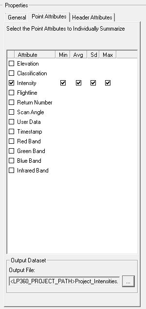
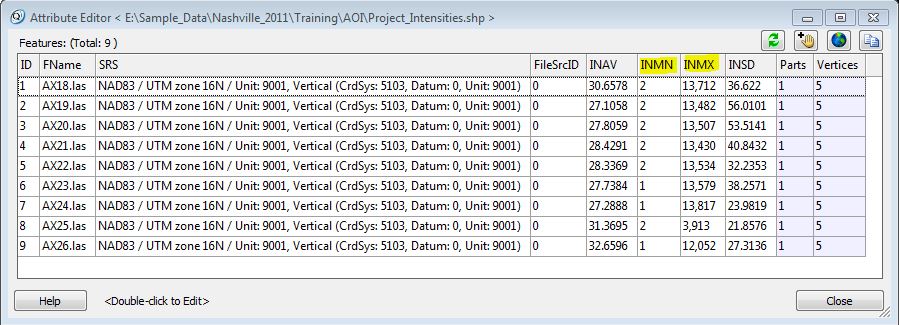
LP360's Point Cloud Statistics Point Cloud Task, can be used to determine the minimum, maximum, average and standard deviation value for intensity values within a LIDAR file. This can be useful if a user is trying to determine what the intensity range is of the dataset. The information is output to a shapefile.
Comments
0 comments
Please sign in to leave a comment.