Classify by Features is a useful way of assigning classifications to points using a spatial relationship to other features. Any vector layer that exists in the Map can be used to classify points that are either within a specified distance of polygon, linear, or point features or any points completely within a polygon feature.
1. From the Point Cloud Task tab of the TOC, open the Point Cloud Task Manager, then select Add Task and choose the Classify by Feature as the Point Cloud Task type.
2. Click the ellipse button under Feature Geometry Layer. Select shapefile under the Type column and specify which layer you will use under the Map Layer Column. 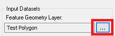
 3. Set the desired Units.
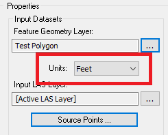
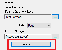
4. Select Source Points to open the source point selection filter. Points classes that are unchecked will not be classified when the task is executed.
5. Specify how the classification will be made under the Spatial Relationship column. 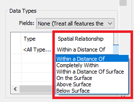
6. In the same window, scroll right to specify the distance and destination class. 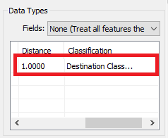
7. Select "Apply" to save the changes to the task.
8. Then, execute the point cloud task using one of the options on the Point Tasks tab of the ribbon.
Comments
0 comments
Please sign in to leave a comment.