
Requires an LP360 Geospatial Basic or above, LP360 Drone, or LP360 Land license.
To assign or modify the Spatial Reference System (SRS) aka Coordinate Reference System (CRS) in a LAS file, use the LAS File Analyst tool on the Project Tab of the ribbon or in the Table of Contents (TOC) right click menu.
- Add the LAS files into LP360 as open for Read/Write.
- Select LAS File Analyst
by right clicking the LAS layer and selecting from the Table of Contents (TOC) right click menu, or from the Project Tab of the ribbon.
- A dialog box will appear in which you choose the LAS files for repair.
- Open LAS File Analyst Options
and select Repair tab. In the Update SRS section, enable the checkbox for "Add WKT".
- Use the ellipses to select the desired SRS to be added to the selected LAS files.
- Select the "Repair" button to add the SRS to the selected LAS files.
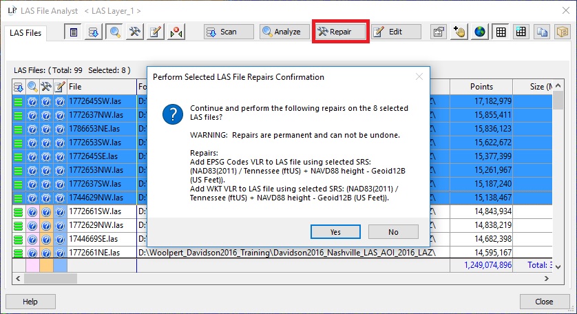
Note: Repairs to LIDAR source files are permanent. Selecting Yes on the confirmation dialog applies the changes to the LAS files and cannot be undone.
This utility will assign an SRS but will not reproject the data. To reproject, use the Reproject LAS PCT.
Comments
0 comments
Please sign in to leave a comment.