Creating an Area of Interest (AOI) boundary can be used to execute Point Cloud Tasks (PCT) and to extract data (or clip data) of a point cloud or raster.
- Select the Create Feature Layer
button on the Feature Edit Tab.
- Use the Browse... button to select an output folder
- Enter the desired name of the Shapefile in the New Feature Layer Name box
- For the Geometry Type of an AOI select 3-D Polygon or 2-D Polygon.
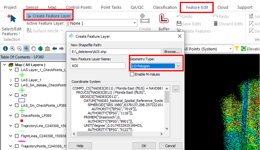
- Once satisfied with the settings, select Ok.
- A new Feature Layer will be added to the Table of Contents (TOC).
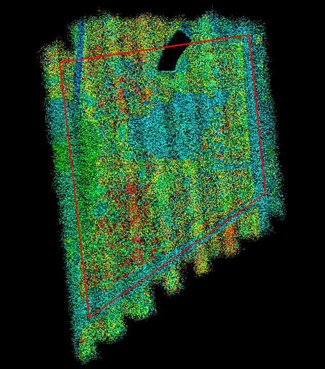
- Next, it is time to create the actual polygon.
- Use the Create Feature
tool to draw the polygon boundary.
- Use the Create Feature
- Once the polygon is complete, press Save Edits
.
Comments
0 comments
Please sign in to leave a comment.