It is always best practice to submit your static base observation data to an online post-processing service to obtain the position of your base station. However, it is possible to process your data with a survey nail/reference mark for a base station coordinate that has not yet been processed to a corrected position. If a base position is needed to check for a fixed solution in the field, one can extract the average position from the header of the base observation RINEX file.
- Download the static data from the base station and convert to RINEX using the specific manufacturer's convert to RINEX utility.
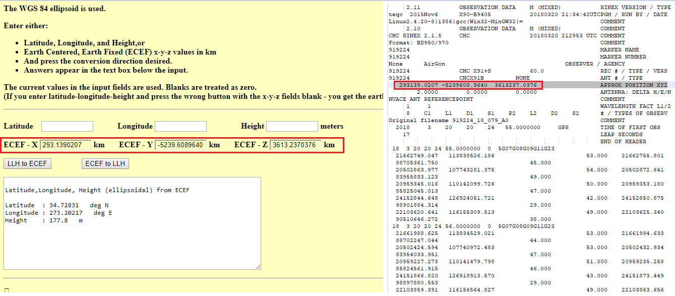
- Open the Rinex file and convert the ECEF XYZ coordinates in the header to Lat/Lon using a converter, such as https://www.oc.nps.edu/oc2902w/coord/llhxyz.htm
- Note: The XYZ coordinates in the Rinex header are in meters and this conversion tool requires inputs in kilometers.
- Manually enter the latitude, longitude, and elevation into LP360 as the base position.
This will not provide good network/absolute accuracy, but it will provide relative accuracy and allow one to perform some quick field checks before the survey has been finalized.
Comments
0 comments
Please sign in to leave a comment.