
Strip Align can be used to adjust not only the flight lines within a single flight but also adjust multiple flights together to create a single aligned point cloud. This article shows how to apply the strip align workflow to adjust more than one flight. For how to use Strip Align or the method and context behind Strip Align.
1. Requirements
There are two requirements to consider when adjusting multiple flights together with Strip Align.
- The flights must be in the same spatial reference system (SRS) and cover a contiguous area with no data gaps between any of the included flights. Flights separated by sections of no data cannot be aligned to each other using Strip Align.
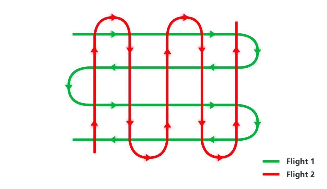
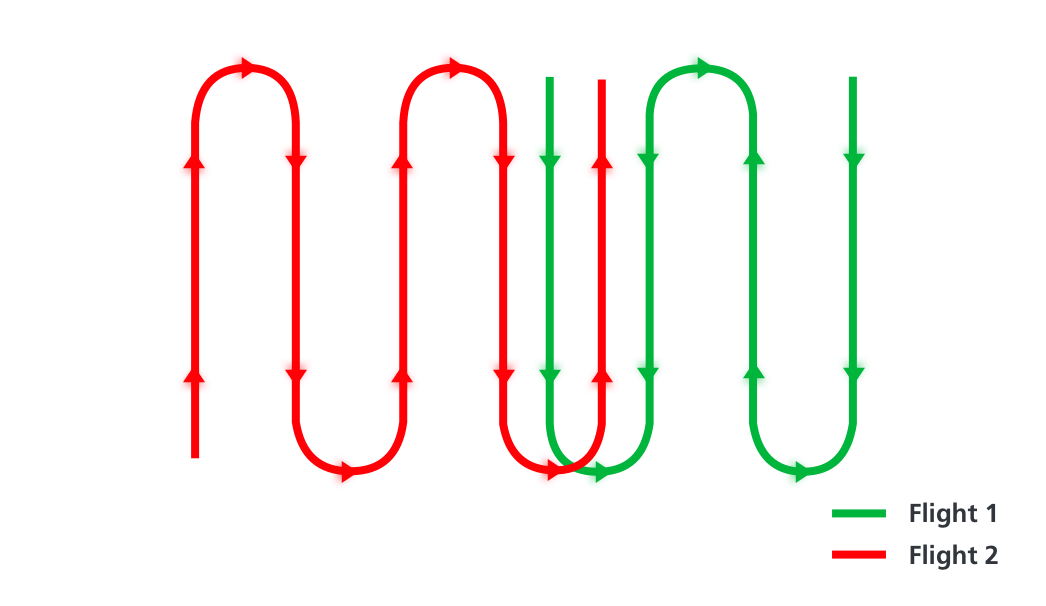
- Each flight must have some area of overlap with at least one other flight in the group that contains suitable points/planes for Strip Align to perform matching. The flights do not need to have full overlap with each other, however the larger the area of overlap, the more effective Strip Align will be in generating a rigorous correction. Having larger or more overlapping areas with another flight and overlapping with more than one other flight will improve the Strip Align correction process.
Examples:
2. Using Strip Align with Multiple Flights
For multiflight collects, if possible, we recommend that all the flights be performed on the same day and all the flights use the same base station. When adjusting multiple flights, there is a risk to transmit an error from one flight to the other, since Strip Align is not able to recognize the quality of each flight. The main source of error during the trajectory processing is associated to the GNSS signals, either in the rover (sensor) or in the base station, so using the same base station on the same day minimizes this error.
| Tip - If all flights are flown on the same day using the same base station, run Strip Align against all flights (LAS layers) with no Fixed layers. Allow Strip Align to adjust across all flights simultaneously to find the optimum correction for the entire dataset. |
If flights are spread across different days or used different base stations, or if there is a known 'bad' flight or flights of lower quality, then the following recommended workflow should be used:
- Process all the flights individually through LiDAR Geocoding (generate the LAS data for each flight).
- Using the trajectory processing reports and visual inspection of the point cloud data along with comparison to checkpoints if available, select the flight or flights that have the best quality and fit best with the survey conditions. Designate these as the Trusted Flight(s).
- Process the Trusted Flight(s) together through Strip Align to create a known good/trusted point cloud. Include all trusted flights as 'Use'; do not include any 'Fixed' layers.
- Perform a QC review of the known good/trusted point cloud generated by Strip Align and perform debiasing to control as necessary.
| Tip - A more rigorous, but time-consuming, approach is to Strip Align each trusted flight separately, QC and debias each individually and then merge them separately to form the known good/trusted layer. This is only recommended if the previous approach of running Strip Align collectively on all good flights fails to generate an acceptable result. |
- Re-run Strip Align selecting to 'Use' all the remaining flights not included in the Trusted Flight(s). Set the Trusted Flights to 'Fixed'. This will generate corrections for the remaining flights that will adjust them to the trusted flights; it will not further adjust the trusted flights. The correction will be a best possible fit but may still contain offsets depending on how poor quality the non-trusted flights are compared to the trusted flights.
3. Tips
- The flights to be adjusted can have different flight heights, speeds, side lap or flight paths.
- If you detect that a specific flight has an issue, for example from the trajectory report, it is recommended to isolate that flight and process this flight separately using the nearest known good flight with overlap as reference.
- It is possible to use as 'Fixed' LAS layers from different point cloud source. For example, mobile mapping LiDAR point cloud or a photogrammetry point cloud.
If you are looking for the step by step on how to use Strip Align.
If you are looking for the method and context for Strip Align, please review the article on Strip Align – Method and Context
Comments
0 comments
Please sign in to leave a comment.